Whitehawk · A much earlier landscape
The Whitehawk enclosure belongs to the Neolithic period, thousands of years before the modern neighbourhood.
Read the official source ↗ (opens in a new tab)
BEYOND THE SEAFRONT · Homes and communities
How Brighton’s neighbourhoods developed
The history of Brighton & Hove includes the homes, schools and everyday streets beyond its visitor landmarks. Later neighbourhoods became communities in their own right.
Explore the story ↓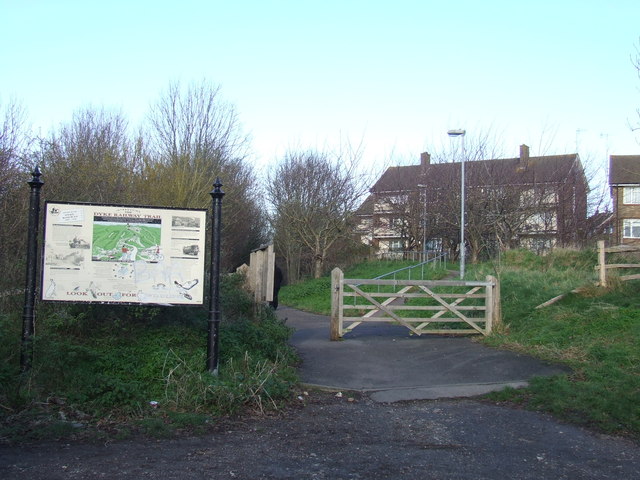
The Whitehawk enclosure belongs to the Neolithic period, thousands of years before the modern neighbourhood.
Read the official source ↗ (opens in a new tab)The council’s housing history identifies Moulsecoomb among the first large-scale developments of this period.
Read the official source ↗ (opens in a new tab)The council records the purchase of 94 acres in Patcham parish in November 1920, followed by annexation into Brighton in 1923.
Read the official source ↗ (opens in a new tab)The city’s growth was not one building project. Regency estates, Victorian streets and twentieth-century housing answered different needs at different times. Moulsecoomb’s early council housing and Hangleton’s later expansion show how development reached beyond the older centres. Read these places as living communities, with histories of everyday work and home life alongside the stories of palaces and piers. The photograph illustrates Hangleton’s former railway corridor, rather than Whitehawk or Moulsecoomb.
Follow the individual area pages for specific buildings and places. For family and house-history research, explore the museums’ collections and local archive resources rather than treating modern neighbourhood boundaries as historical ones.
Checked 21 October 2026. Programmes, access and opening times can change. This is Via’s independent guide; listings do not imply a partnership. Photographs show real places at their credited dates, not film or television stills. Images are resized and cropped for display.